Latest news follows below.
Mekong Delta Plan: TAG meeting in Ho Chi Minh City, Vietnam, of communication and information dissemination strategy project for the principles and recommendations
On June 12 and 13, 2017, we took part in the meeting of the Technical Advisory Group (TAG) in Ho Chi Minh City of the Mekong Delta Plan project on communication and information dissemination strategy. Together with IHE, IUCN, Can Tho University, Fresh Studio, Water.NL, and KnowH2O, we discussed on state of the project’s work packages. On June 13, 2017, Robert Proost of RVO-Netherlands and Tom Kompier of the Royal Dutch Embassy Vietnam joined our TAG.
The Mekong Delta Plan (MDP, 2013) contains specific recommendations for a safe, sustainable, and prosperous long-term development for the delta, as well as more generic recommendations on institutional strengthening and transboundary cooperation. We are working on key messages for provincial civil servants and for farmers in the Mekong Delta, as well as on the communication strategy, on training materials, and on the organization of a ‘Train the Trainers’ workshop later this year.
SPECTORS Interreg V-A field campaign Hupsel Brook catchment
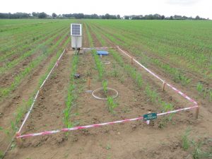
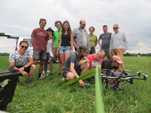
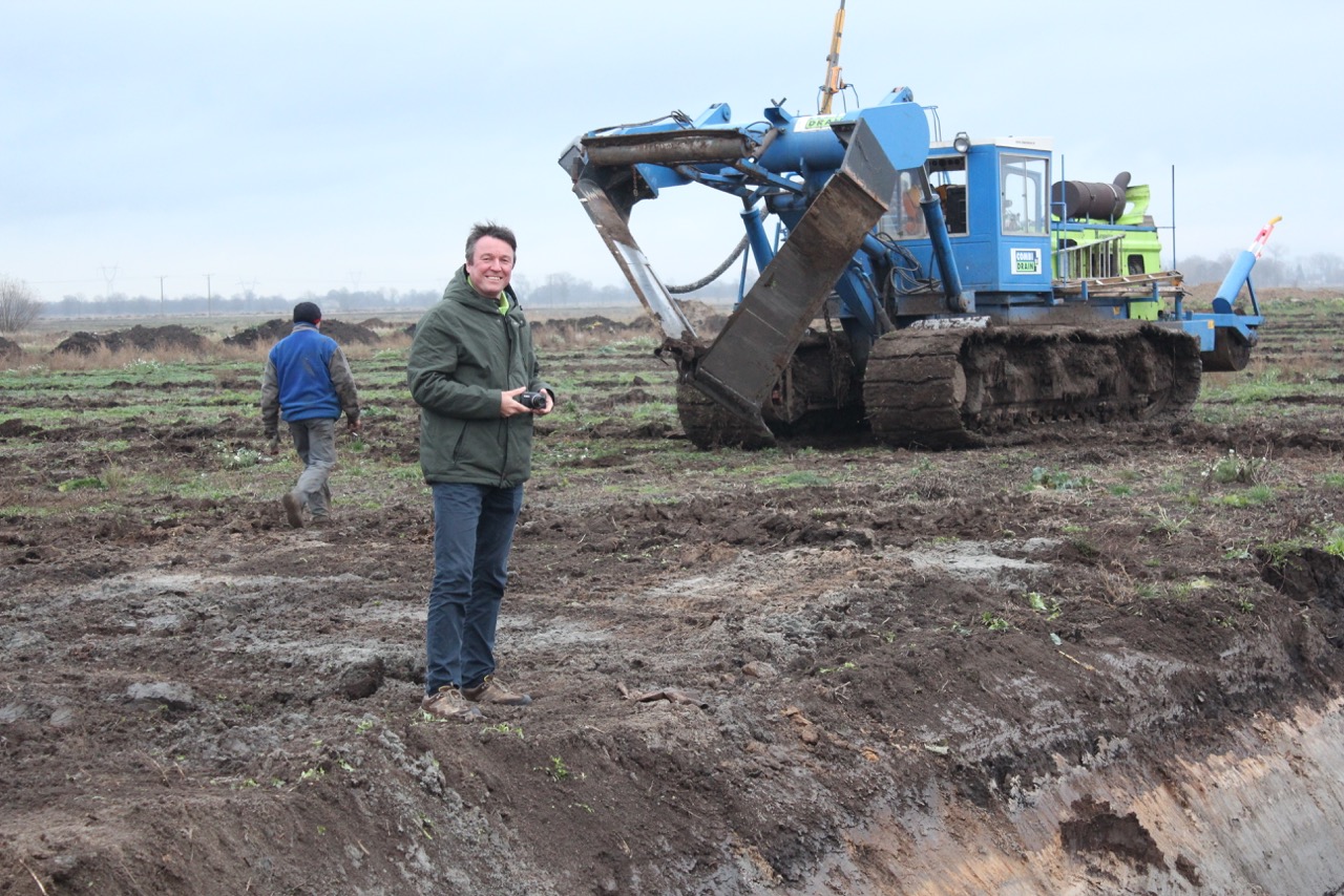
On May 31, 2017, we conducted a SPECTORS Interreg V-A project (EU) field campaign at the Hupsel Brook catchment, in use as an open air field laboratory since 1965. Joint forces of Wageningen-UR Geo Information Science and Remote Sensing, KWR Watercylce Research Institute, and KnowH2O got together successfully. A WUR-student group on Academic Consultancy Training, with KnowH2O, KWR, and Rijn & IJssel Water Board as commissioners, assisted very well and teamed up along with us.
We conducted field observations at the KWR 2.8 ha lysimeter test field within the catchment, performing ground measurements as well as from the air, using a RPAS. Surface temperature, soil moisture, and soil compaction measurements took place, along with hyperspectral and thermal infrared (TIR) observations flying the RPAS. Parallelly, we covered the 650 ha catchment as a whole with TIR, NIR, and RGB-colour images, which were organized by KnowH2O and facilitated by DRO Remote Sensing.
Data elaboration has started. To be continued…

SPECTORS – Meeting of Working Group Natural Resources
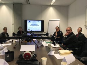
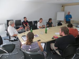
On February 6, 2017, KnowH2O attended the SPECTORS Interreg V A project meeting of the Working Group (WG) on Natural Resources at the Wageningen Campus. WUR-SLM hosted the meeting. WUR-GRS was present and showed the new Riegl RPAS of WUR, as well as the new LiDaR system, of the WUR UAV Research Facility. Naturschutzzentrum Kleve e.V. (D) was also present, besides Geo Info Solutions, Bureau Waardenburg, KWR, and Clear Flight Solutions. After a round of introductions, we shared ideas on the work to be done and how to cooperate with each other. Based on the brainstorm session, a plan will be set up for this WG and, also to address the relevant Product Groups in the coming time.
TKI-Dotter project: field experiment @REC, KICT South Korea
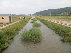
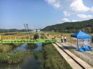
The TKI Dotter-project by Deltares, KICT River Experiment Center (REC) South Korea and KnowH2O, is moving forward. Visiting the REC from September 20-30, 2016, we have performed experiments in the test channels at the REC site. These channels have a pre-known aquatic vegetation and can be supplied with controlled discharge rates, operating under different water levels by downstream weir control management.
We have used our hyperspectral camera to take images of the aquatic vegetation present along a 150 m long section of the straight test channel. The 1:1 scale channel we have used, is supplied with water from the Nakdong River by pumping stations. We conducted field experiments with discharge rates of 1 and 3 m3/s at two different water levels. We will elaborate the field data and hyperspectral images, targeted at reproduction of the vegetation that is actually present in the test channel. To be continued.
REC (http://rec.kict.re.kr/english/intro/hello.asp)
Soil moisture, evaporation, and hydrology: working visit to IBG – FZ Jülich (D)
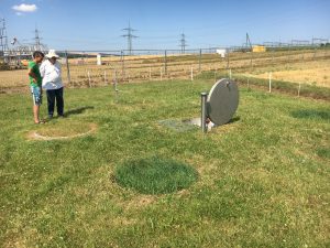
On 20 July 2016, Henk de Bruin and Gé van den Eertwegh took a working visit to the Institute of Bio- and Geosciences (IBG) of Forschungszentrum Jülich (D), invited by prof. dr. Sander Huisman. In the morning we were presented research results and discussed with Sander Huisman, Wolfgang Kurz, Hannah Fuchs, Alexander Graf, and Inge Wiekenkamp. Subjects were ‘soil water content – monitoring in time and space and integration of different monitoring techniques in time and space’, using COsmic-ray Soil Moisture Observing System (COSMOS) and SOILNET monitoring networks. Also we talked about evaporation and ‘footprints of EC and COSMOS, with local land and water management aspects’. We further discussed the use of lysimeter-data (TERENO project). Also ‘catchment hydrology’ of the Wüstebach Einzugsgebiet (Eiffel) was discussed, with monitoring networks of 150 locations with soil moisture sensors and two locations with EC-sites. In the afternoon, we visited the Selhausen-testsite south of Jülich. We watched COSMOS-monitoring equipment, a field-rhizon-lab, meteostation and lysimeters. The latter consisted of four times a hexagon-setop of six lysimeters, with a service- and control well located in the middle.
Vietnam mission on water, agriculture, and climate change (March 1-11, 2016)
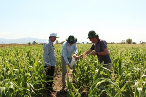
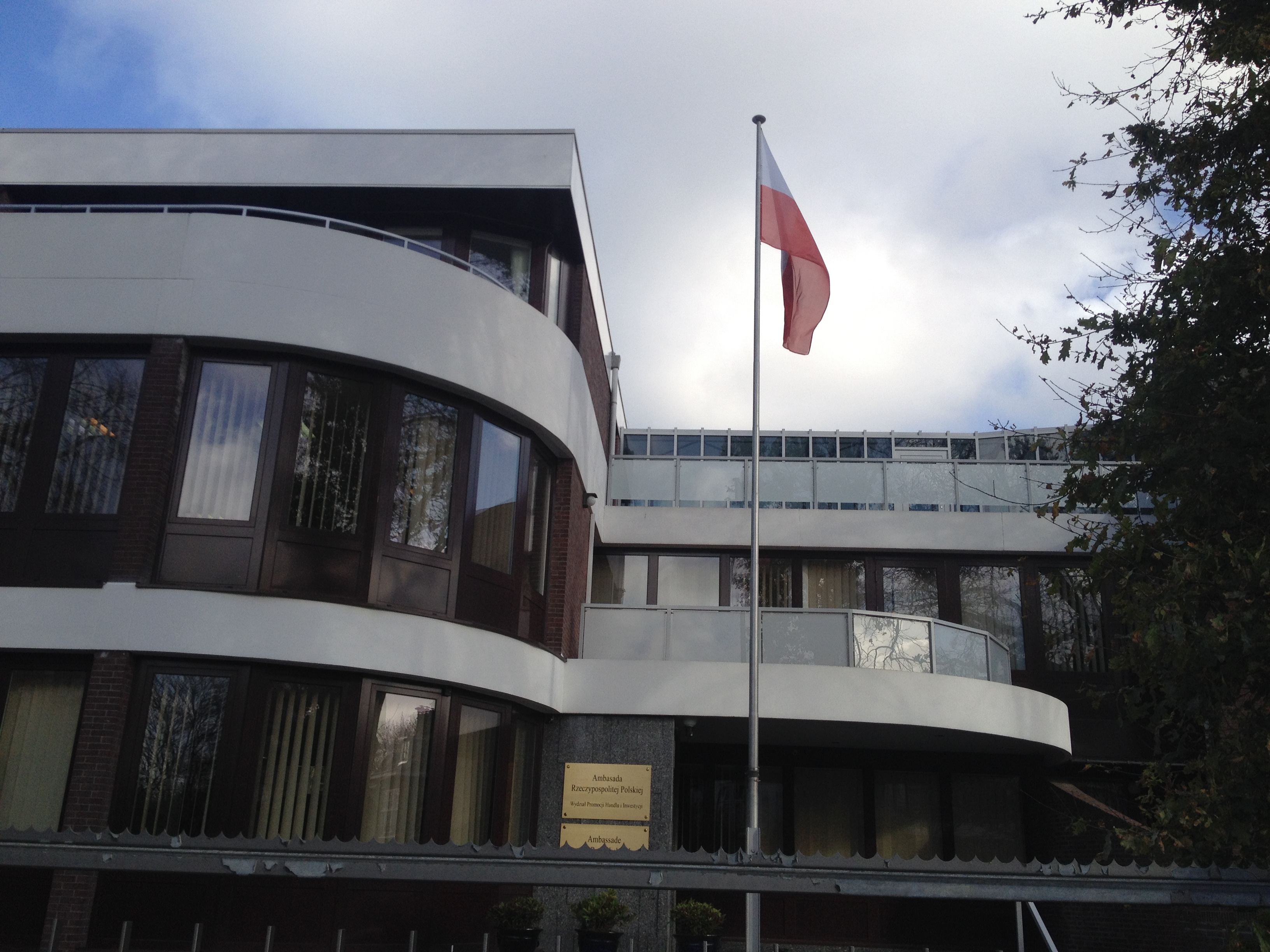
In strong cooperation with the Viet Nam Farmer’s Union (VNFU) International Cooperation Department, Prins – Land, Water & Food Consult and KnowH2O have performed a mission to rural Vietnam. We were invited by the Viet Nam Farmer’s Union VNFU and sponsored by the Netherlands Water Partnership. This mission visited Vietnam from March 1-11, 2016. Objective of this mission was to identify the needs of VNFU on the topics of water and climate change and to find a common base for possible projects. Therefore, several meetings were organized with VNFU at the province level in Bac Lieu, Ninh Thuan, and Binh Thuan province, with government representatives of MARD and MONRE, and with delegates from knowledge institutes like SIWRR and VAAS. In Hanoi, we also visited MARD, MONRE, VNFU-HQ, and the Dutch Embassy.
Our mission on ‘Water and Agriculture in Vietnam: Towards a climate-change resilient approach, by integrating local and regional scale issues’ focused on drought, salinization, and irrigation. We paid attention to the local and regional scale, from the farmer’s point of view. During the mission, we identified regions and crops which have to cope with extreme weather events, causing drought and salinization. We discussed the outline of project ideas. VNFU will play an important role in bridging the gap between science and the grass root level, fostering feasible solutions for Vietnamese farmers. We not only focused on water, but also took soil structure and soil chemistry, fertilization, and crop growth into account as well, integrating solutions at the farm level.
For the near future, we will aim at establishment of Vietnamese/Dutch partnerships, with public and private partners involved, which might be successful in applying grants for projects and beneficial loans for investments in irrigation systems and training of VNFU-staff and farmers.
To get an impression of our mission, watch the video at Prins – Land, Water & Food Consult (our partner):
http://landwaterfood.com/news?news_id=354463
Vietnam mission on water, agriculture, and climate change (March 2016)
During the General Assembly of the World Farmers’ Organization in June 2015, Peter Prins/NWP met with the delegation of the Viet Nam Farmer’s Union VNFU. We discussed the problems that Vietnamese farmers face due to severe drought and salinization, and concluded that collaboration between VNFU and Dutch experts on Water, Climate Change, and Agriculture might be fruitful.
In strong cooperation with the VNFU International Cooperation Department, we have setup a mission to Vietnam with Prins – Land, Water & Food Consult. This mission will visit Vietnam from March 1-11, 2016. Objective of this mission is to identify the needs of VNFU on the topics of water and climate change and to find a common base for possible projects. Therefore, several meetings are organized with VNFU at province level in Bac Lieu, Ninh Thuan, Binh Thuan, with government representatives, and with delegates from knowledge institutes.
During the mission we want to identify regions and crops which have to cope with extreme weather events, causing drought, and with salinization, including the outline of project ideas. VNFU can play an important role in bridging the gap between science and the grass root level, fostering feasible solutions for Vietnamese farmers. We will not only focus on water, but will take soil, fertilization, and crop growth into account as well. We aim at establishment of Vietnamese/Dutch partnerships, with public and private partners involved, which might be successful in applying grants for projects and beneficial loans for investments in irrigation systems.
Partner: Prins – Land, Water & Food Consult![]()
NWP-mission to Poland on Agriculture and Water, November 16-19, 2015
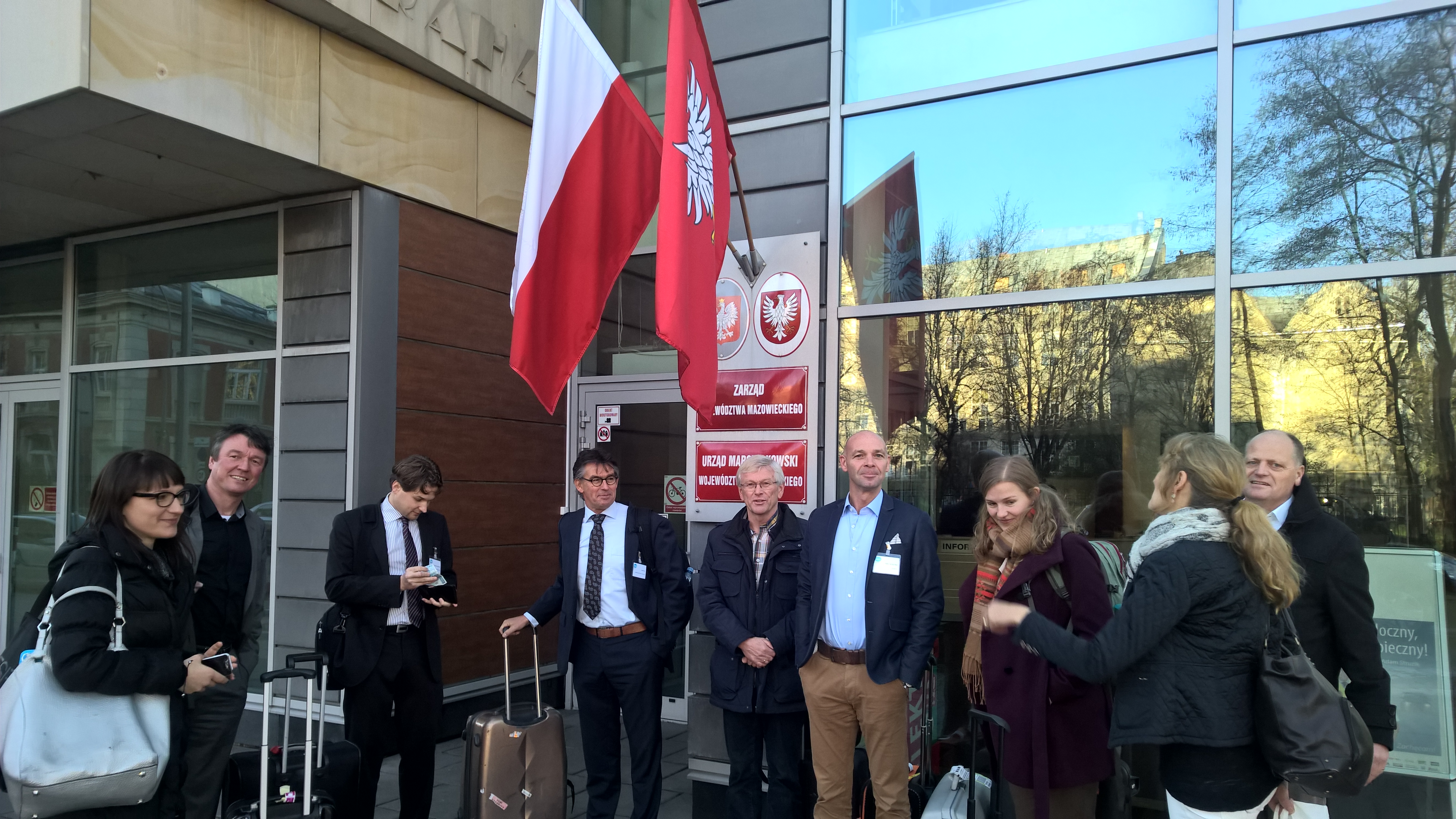
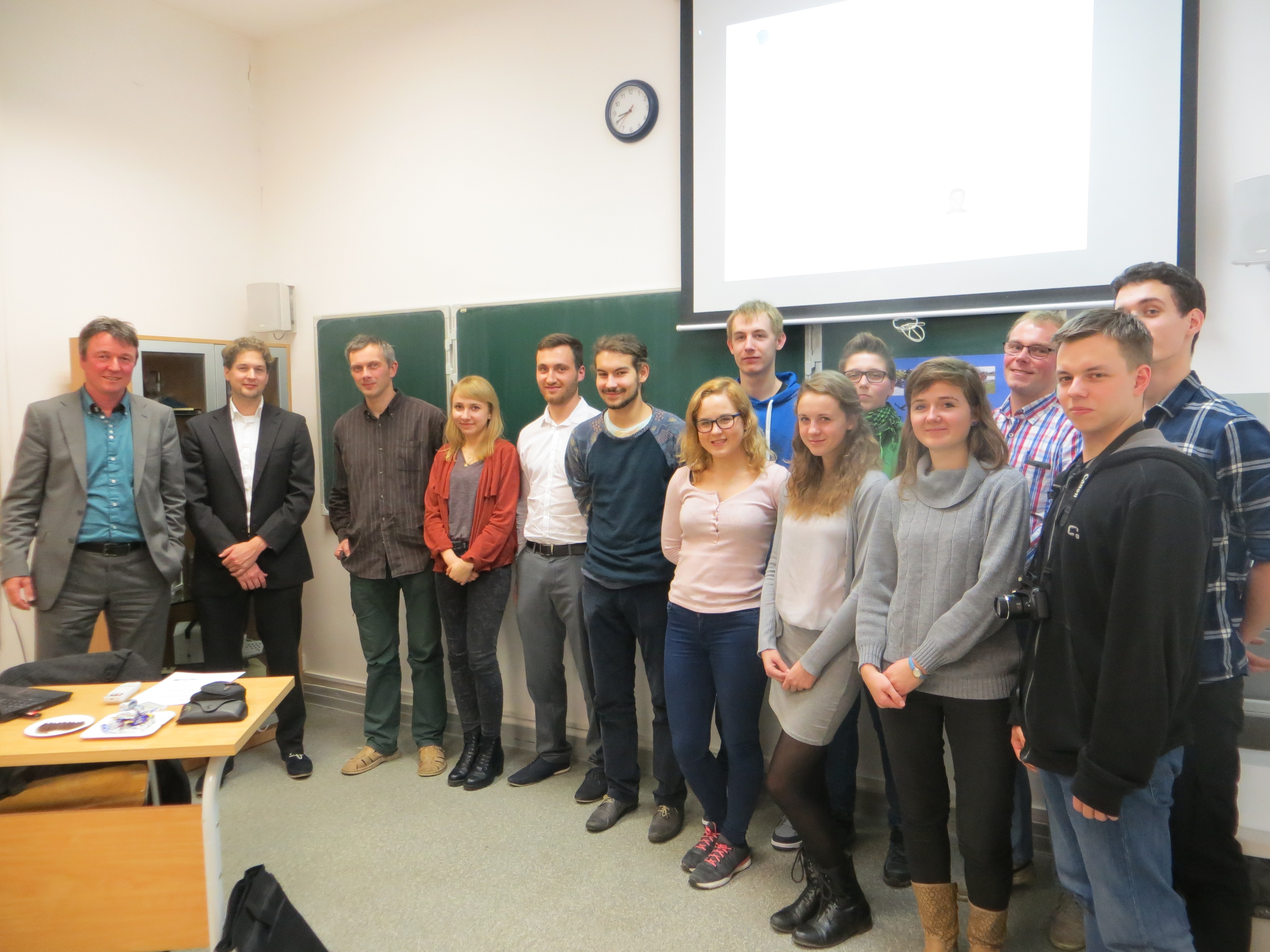
We have taken part in a mission of the Netherlands Water Partnership (NWP) on agriculture and water in Poland. This mission took place from November 16 to 19, 2015. In total eight Dutch companies visited Warsaw, Minikowo, and Gdansk. We visited the RABO-Farm with arable crops at present and a drainage system under construction, and a large potatoe farm east of Gdansk. We met and discussed with regional government-departments on the subject (province-voivode), with employees of the regional Extension Service (MODR, KPODR, PODR), and with university researchers (Warsaw, Gdansk) together with potential partners and clients. We represented FutureWater during this mission. We attended the briefing at the Embassy of the Republic of Poland in The Hague, organized by NWP and the Trade and Investment Promotion Section, which is run by Tomasz Wazbinski.
We elaborated our contribution with Climate Adaptive controlled Drainage systems (CAD), subirrigation, and online irrigation services. We think and work from parcel to region and vice versa, to connect the local farmer’s needs with regional-scale freshwater availability.
See also NWP-News Letter no. 42.
Monitoring of aquatic vegetation for hydraulics and ecological targets
We have attended a meeting on November 5, 2015, with partners of Deltares and of the Korea Institute of Civil Engineering and Building Technology (KICT) to discuss near-future cooperation. All parties are interested in spatial monitoring of aquatic vegetation, for hydraulic purposes and for aquatic-ecological aspects. Water managers deal with this vegetation in a way that it is on one hand serving ecological targets (EU WFD), but on the other should not hamper the water transport capability of brooks, channels, and rivers. Reduced water transport capability can possibly lead to summer floods. We want to look at monitoring techniques, combining field and ground-truth measurements with remote sensing or airborne sensing. The KICT River Experiment Center (REC) could be useful for test purposes.

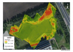
Remote sensing and water quality: surface water temperature
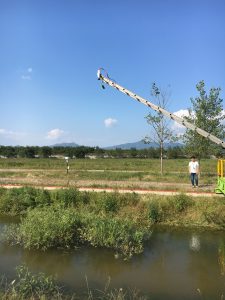
UAV with thermal camera mounted
The surface water temperature is an important factor in water quality, driving several biochemical and other processes. The spatial resolution of thermal images from space by satellites are usually to coarse to apply to small surface water bodies. Using Unmanned Aerial Vehicles (UAVs), this problem can be solved.
It is possible to mount different camera systems on UAVs. Measurements with thermal cameras can be mounted to give in an indication of temperature and its spatial pattern. Because thermal wavelengths are more to the end of the light spectrum, the wavelengths are long and contain less energy than those in the visible spectrum. Because of this low energy, it is difficult to measure temperature with satellites with a high resolution as the lightwaves have to travel a long distance. With UAVs, and to lesser extend airplanes, this distance is much smaller, making UAVs and airplanes mounted with a thermal camera efficient and accurate monitoring tools.
The result of a test flight mid June 2015, by Wageningen University students of the Laboratory of Geo-information Science and Remote Sensing, using an UAV with a thermal camera mounted, proves the feasibility of this method. The figure below shows the measured temperature pattern. It indicates in this case that the spatial variation in the pond is rather small, as the surface water temperature is rather homogeneously distributed across the pond. As the variation of temperature in the surrounding vegetation is visible, large temperature difference in the water body would also have been visible when present.