Client: Topsector Water, National Government, The Netherlands
Partners: Deltares (NL) and Korean Institute for Civil Engineering and Building Technology
Period: 2016
Objective: Developing remote sensoring and data processing techniques on mapping of aquatic vegetation for improved water management
Summary
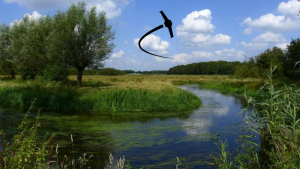
Seasonal development of vegetation in streams and rivers can introduce enlarged flow obstruction, and increased flood risk upstream of dense vegetation patches. At the same time vegetation is a natural aspect of flowing waters and valued for its ecological services and provision of habitat for other organisms. Therefore, aquatic vegetation is an explicit part of the EU-Water Framework Directive (EU-WFD), aiming at water quality targets by 2027.
When vegetation obstructs flow it must be removed by mowing, cutting down trees etc. Methods to determine the threshold of acceptable levels of biomass in streams are for example relationships between discharge and water levels: when water levels upstream increase beyond a given point with a given discharge the overall roughness in the channel has increased too much as a result of vegetation development and mowing must be carried out. When discharge capacity is becoming too small field assessments must be carried out to identify where and how much vegetation must be removed. Currently this is often done based on expert judgement by individual persons, and objective quantifying methods are lacking.
Regional water authorities usually have limited information and knowledge on stream vegetation present. Point or section measurements are available at a small number of moments in time. This hampers the EU-WFD field monitoring achievements and has negative feedback on policy aspects and measures taken, to enhance the presence and quality of stream vegetation.
The Dotter project aims to develop new techniques to determine where the true obstacle points in a stream are and at the same time identify the ecological values that the vegetation represents in a quantified manner. By transforming data on patches into roughness coefficients, based on bio volume and species characteristics, we define the true obstructions in the stream. By only removing these true obstructions, as if ‘dottering a vein’, other valuable patches can remain unharmed. The determination of ecological values of the stream vegetation in this project aims at aerial mapping of the occurrence of vegetation and recognition of vegetation patterns. We will look at the feasibility of recognition of vegetation species.
New UAV and camera techniques, e.g. full spectrum cameras, enable to automatically map larger stretches of rivers and translate these images into spatial maps of vegetation cover, biomass and species composition. By using full spectrum cameras and an automated flight path, this information can be obtained quickly and processed objectively. Via a validation experiment in the River Experiment Centre of the Korean Institute for Civil Engineering and Building Technology in Andong, South Korea, the developed technique will be further improved.
We will demonstrate the use of UAV and cameras involved in The Netherlands by demo flights across selected streams in management areas of regional water authorities taking part in the project.